RENFODA – JICA project
Duong Tien Duc, Joosang Chung
Department of Forest Resources,
College of Agriculture and Life Sciences, SeoulNationalUniversity
ABSTRACT
In this study, investigated were the changes in land use patterns of the Northern area of the Da River basin, Vietnam, over the period of 1993 through 1999 using remote sensing techniques. LANDSAT5 and LANDSAT7 satellite images were used as a set of source data to assess the changes in land use patterns with ERDASIMAGINE 8.6. The land use patterns of the area in 1993 and 1999 were classified into 5 major land use types including the developed land, wetland, bare-or-disturbed land, tropical evergreenforestland, and agro-or-plantation forestland. Then, the changes in areas of land use types during the period were assessed with such post-classification methods as supervised classification with maximum likelihood algorithms.
Keywords: changes in land use patterns, Da river basin, Vietnam, LANDSAT
INTRODUCTION
Satellite remote sensing has been recognized as a powerful and effective tool in detecting land use and land cover changes (Meaille and Wald, 1990). This is due to the strong points of satellite remote sensing techniques to providevaluable information, in a cost-effective way, by processing multi-spectral and multi-temporal data.
Often satellite imagery has been used to monitor discrete land use and land cover types by spectral classification or estimate biophysical characteristics of landsurfaces via linear relationships with spectral reflectances or indices (Steininger, 1996). The timely measurementof environmental change and assessment of its impacts on surrounding environmentisgetting important more and more in sustainable forest management. The effectiveness of satellite remote sensing techniques has allowed us to use the skill of “change detection” in identifying and locating the changes in the state of an object or phenomena through the examination of the changes in radiance values between sets of multi-temporal satellite images (Wang, 1993).
The most commonly used techniques for land use change detection includes image differentiation, post-classification comparison, principal component analysis, and change vector analysis (Jensen and Toll, 1982). These techniques have been used successfully to identify areas of change in urban and remote areas throughout the world.
However, the techniques of remote sensing have rarely been applied to determination of the spatial and temporal patterns of land use types, and assessment of change in land use types in Vietnam. Thus, this study was an attempt to apply the remote sensing techniques to assessing changes in land use patterns of the Da river basin over the period of 1993 through 1999 in Vietnam. In order to achieve the goal, carried out were classify the major land use types of the area in both 1993 and 1999using LANDSAT image processing and to assess the changes in land use patterns during the study period.
MaterialS and methodS
Study area
The Da River has its origin in southern China. The river has a total length of 980 kilometers of which 480 kilometers runs though Vietnamese territory until it joints the Red river (PaulandKhiem, 1993). The basin area is the most mountainous region in Vietnam with the average elevation of more than 500 meters and the highest elevation of nearly 3,200 meters.
The basin area is well-known for the Hoa Binh Hydroelectric dam, which is the largest hydroelectric power plant in Southeast Asia. The power plant is located at the outlet of the basin in Hoa Binh.
The mountain ridges of the basin area spread out five neighboring provinces as Lai Chau, Son La, Hoa Binh, Lao Cai and Yen Bai as shown in Figure 1. According to the recent survey in 2001, the whole basin area of about 5 million ha is composed of 42 districts and 847 communes. The population of the whole basin area is about 3.6 millions with 23 ethnic minority groups. The ethnic groups have their own culture, language andagricultural practices (General statistical office of Vietnam,2001).
Forested area in the basin has been decreasing in both of quality and quantity due to inappropriate and unsustainable exploitation of timber, shifting cultivation, and slash-and-burn farming. The poor and fast-growing population in the area demands more agriculture land for their living. Fallow periods on agricultural land are getting shorter and shorter without any compensatory measure and even steep slopeforestlands are being brought under cultivation. As a result, erosion of topsoil is being accelerated and soil fertility and forest environment are rapidly getting worse and worse because of unfavorable land use practices for watershed management. Currently it is reported that about 70% of the whole forestland has been seriously degraded (General statistical office of Vietnam, 2001).
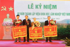
Latest news
- Project: Study on integrated management of insect pests and diseases on Docynia indica in northern Vietnam
- Project: Study on integrated pest management of major leaf insect pests and stem borer beetles in Acacia hybrid, A. mangium and A. auriculiformis in Vietnam
- Project: Research and develop an integrated management program for control of cinnamon pests in some main cinnamon growing areas (Northern mountainous region and Quang Nam province)
- Project: Pilot plantation and completion of planting techniques of technologically advanced germplasm of Acacia auriculiformis (AA42, AA53, AA56, AA92, AA95) for sawlog in the southeast and south central.
- Project "Research on selection of varieties and intensive afforestation techniques of Prunus arborea (Blume) Kalkman for providing lager timber in the Northeast and Northwest regions, Vietnam"
Oldest news
- Illustrated pictures of Native Tree Seedling Production
- Conservation Status and Breeding Work of Conifer Species in Vietnam with Reference to Pines
- Conservation prospects for threatened Vietnam tree species: results from a demographic study
- Phytogeographic review of Vietnam and adjacent areas of Eastern Indochina
- Conservation prospects for threatened Vietnamese tree species results from a demographic study